HOME IMPROVEMENTS
Commonly Requested Information about general residential construction and remodeling, such as additions, accessory structures, and swimming pools can be found in the Residential Handouts below, and/or by speaking with the Planning Department at Town Hall.
Permits are required for all new construction. In addition, residential permits are required for additions, accessory structures (sheds, pergolas, fences, patio covers), curb cuts, and pools. If your work only involves interior renovations, remodeling, or electrical you may contact Shelby County Codes directly.
Building Codes, Policies, and Permits – Building permits must be submitted on a standard Shelby County form and turned into Town Hall for initial approval. Once approved, the Town will submit to Shelby County for processing, as the Town of Arlington contracts with Memphis/Shelby County to perform building permit review and inspection services. .
No permit is required for work such as: new carpet, paint, fans, new roof shingles, etc. If there's a question, it's always best to call first to confirm (901-867-3449).
Arlington Zoning Code – the Arlington Zoning Code provides regulations for structures, permitted uses, and parking by zoning designation.

PROPERTY INFO / DETAILS
County Property Records – find County property records for real estate including: property summary, taxes, assessment values, local neighborhood sales, etc.
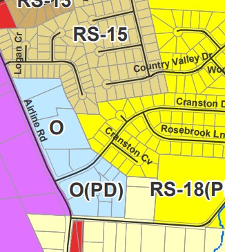
Arlington Maps – check the Arlington Maps portal to find a variety of maps including: the Town Zoning map, trash collection zones, Future Land Use map, government facilities map, and schools and parks map.
Arlington Zoning Code – with your property's zoning designation, you can use the Zoning Code to understand lot development requirements. *Note - while the Zoning Map will identify any property's underlying zoning, many neighborhoods were built under a Planned Development (PD) process that may have slightly different regulations for that neighborhood. Always reach out to Town Hall or check the recorded PD or Plat for your neighborhood to confirm the regulations in place before planning any construction project.
FEMA (Flood) Map Service Center - The FEMA Flood Map Service Center (MSC) is the official online public source for flood hazard information produced in support of the National Flood Insurance Program (NFIP). Use the MSC to find your official flood map and access a range of other flood hazard related products.

